GIS Training Opportunities - Hopland

The University of California – Division of Agriculture and Natural Resources will be holding two introductory courses in GIS and WEBGIS at the Hopland Research and Extension Center on May 7th and 8th.

Geographic Information Systems (GIS) for Agriculture: Rangeland Focus Workshop
Thursday, May 7th, 2015, 11am to 4pm
Rangeland Workshop Flyer

WebGIS Workshop: Creating your own Web Maps
Friday, May 8th, 2015, 8am to 12pm
WebGIS Workshop Flyer

Both workshops will be at the Hopland Research and Extension Center at 4070 University Road, Hopland, CA.
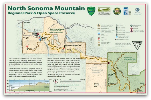
North Sonoma Mountain Regional Park

Last month Sonoma County Regional Parks opened up to the public the latest regional park - North Sonoma Mountain Regional Park. With the opening of this park we get another North Bay map. You can view the map in PDF form on the North Sonoma Mountain Regional Park page.

This new park includes 4 more additional miles added to the Bay Area Ridge Trail and connects to Jack London State Historic Park. To learn more about the Bay Area Ridge Trail go to http://www.ridgetrail.org.

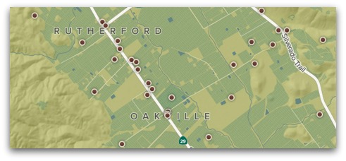
Napa Valley Vintners Map

There is a new interactive map for our region. This one was created by Axis Maps for the Napa Valley Vintners. To view the map go to http://napavintners.com/maps/.

Axis Maps also has a blog post about some of the design workarounds to get it to work in the mobile environment.

Thanks for a great Mappy Hour!

On Wednesday, January 28th we had our first Mappy Hour at Griffin Map Design. Esther Mandeno of Digital Mapping Solutions did a great write-up on it at http://digitalmappingsolutions.com/2015/01/30/mappy-hour/. So rather than repeating her words we are just going to say thanks to all who attended and look for another one in the months ahead.

Come join us for our first ever Mappy Hour!

You might be asking yourself, "What is Mappy Hour?" Mappy Hour is an opportunity for GIS and Mapping folks to get together for a good time... and talk maps.

So come join us at Griffin Map Design in Petaluma on Wednesday, January 28th from 6-8PM. Our host Scott Lowrie will be giving an introduction to Mappy Hour and Griffin Map Design. Then Kevin Lacefield will give a short talk about what the upcoming year will hold for the North Bay GIS Users Group.

For additional information go to http://www.griffinmapdesign.com/events.

@NorthBayGIS

We have created a Twitter Account to help you keep informed on the latest North Bay GIS news. Go to https://twitter.com/NorthBayGIS to follow us.

Also, don't forget to join in the conversation over on our LinkedIn Group.

SonomaVegMap Fall 2014 Newsletter

The latest SonomaVegMap Newsletter is out with some fantastic stories including Wider Access to 2013 LiDAR Data, LiDAR Assists in Road Design, and Vegetation Classification Work. Go to http://sonomavegmap.org to read it.

Spring 2015 GIS Courses at SRJC

SRJC Logo There are four courses being offered by SRJC for the Spring semester. They are GIS 40 (Intro to GIS), GIS 51 (Intermediate GIS), GIS 52 (Advanced GIS), and GIS 56 (GIS Applications in Land Planning).
 

Go to Schedule of Classes for more info.

North Bay GIS Day 2014

The largest GIS Event in the North Bay is coming November 19th to Santa Rosa and we need your help!

We need you to spread the word about it, participate in it, and attend! GIS Day is only as successful as the effort our User Group puts into it. .

Post the event on your website. Go to our resources page and download images to use on your site.

North Bay Interactive Map Inventory

Do you or your agency have an interactive map online for public consumption? If so, send us a link to it. We are putting together a new page on this site which will showcase the interactive maps for our region.

Send interactive map links to This email address is being protected from spambots. You need JavaScript enabled to view it.

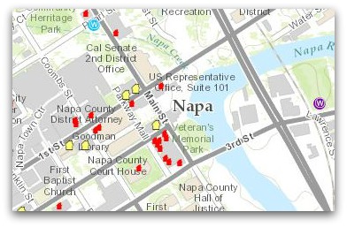
Napa Earthquake Information Map

The City of Napa has released an interactive map showing locations of damaged buildings, water leaks, and debris dropoff sites. You can view the map at http://ow.ly/AN09W.

The Addictive Local Story Map

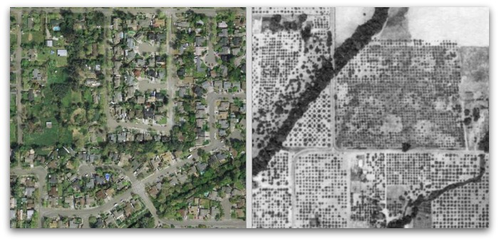
Warning, the latest story map for our area is highly addictive. Click the image below to see just how much has changed in the Santa Rosa Plain since 1942. You can read about this project on the SonomaVegMap Blog.

1942 and 2011 Aerials of the Santa Rosa Plain

Page 2 of 3

Social Media Channels

Twitter logo   Facebook logo   LinkedIn logo

Upcoming Events

No events

Donate

You tax-deductible donations help us educate, support, and promote GIS in the North Bay.

Donate

Donations are made via MarinLink.
Use NB GIS for Project Name.

Copyright © 2020 North Bay GIS User Group. All Rights Reserved.